Tuesday, September 7th 2021
Groundwater Quality in Guanajuato

Written by
Rafael Bracho
Get Instant Quotes
Find out today why thousands of expats use us as their trusted brokerage abroad. Click below to get instant quotes to all of our providers.
Quote NowJoin our newsletter!
Groundwater Quality in Guanajuato
In Mexico, we are all concerned about the water that we ingest. As surely as water gives life, when contaminated, it can have disastrous effects on our health and wellbeing. In this comprehensive inquiry into the quality of the groundwater in Guanajuato, Expat Insurance explores what contaminants lay in the buried recesses of the groundwater in Guanajuato, what effects it could have on our health, and whether or not it is related to the overexploitation of this natural resource for the purposes of industry and agriculture.
In the end, we hope that this will be a call to action to all those who live in the Mexican state of Guanajuato to better inform themselves and ensure that their most precious resource is cared for so that future generations can also live healthy, prosperous lives.
TABLE OF CONTENTS:
-
About Groundwater - Introduction to Groundwater - About Aquifers
-
Unsustainable Use of Groundwater Around the World
- Regulations to Protect Groundwater Levels
-
Groundwater in Guanajuato, Mexico
- Conflicting Legal Precedent for Groundwater Use
- The Ineffectuality of Groundwater Regulations in Guanajuato
-
Groundwater Quality in San Miguel de Allende
- Notes About the Natural Features in San Miguel de Allende Municipality
- Groundwater Study in the San Miguel de Allende Municipality
- Findings of Groundwater Study in the San Miguel de Allende Municipality
- Fluorine
- Arsenic
- Lead
- Nitrates
- Bacteria
- Conclusion of the Water Study in San Miguel de Allende
-
Radiation Found in Aquifers in Guanajuato
-
A Note on The Differences of Water Terms and Their Relationship to the Efficacy of Water Policy
ABOUT GROUNDWATER:
Introduction to Groundwater
Groundwater is the universal choice around the world for people's primary source of fresh water. The availability of high-quality water nearly everywhere, and the relative ease of its extraction through different methods of tubewell technology, makes it ideal in nearly all facets of water use, including:
Industrial Use
Agricultural Use
Urban Use
Domestic Water Provision (Urban and Rural)
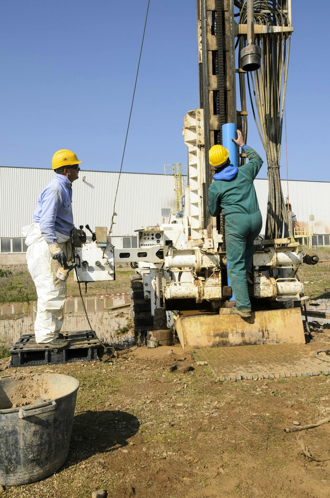
Groundwater is often available on-site, and the wells dug generally tap into largely isolated reservoirs, therefore this provides an excellent source of reliable, inter-annual storage water available whenever the need should arise. This makes groundwater use the preferred use of those listed above—and crucial in the operation and production of many societies around the world.
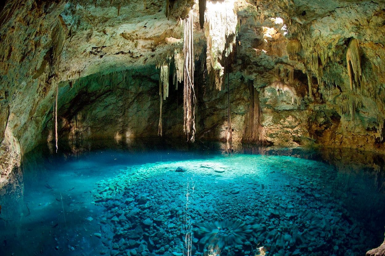
When we think of groundwater, we often picture water flowing through porous rock. However, in reality, it can also contain permafrost, soil moisture, immobile water, and oil. Groundwater collects in soil pore spaces or fractures in the rock. Occasionally, groundwater will discharge to the surface and create springs, oases, or seeps. However, for the purposes of our discussion, generally, groundwater is collected in aquifers.
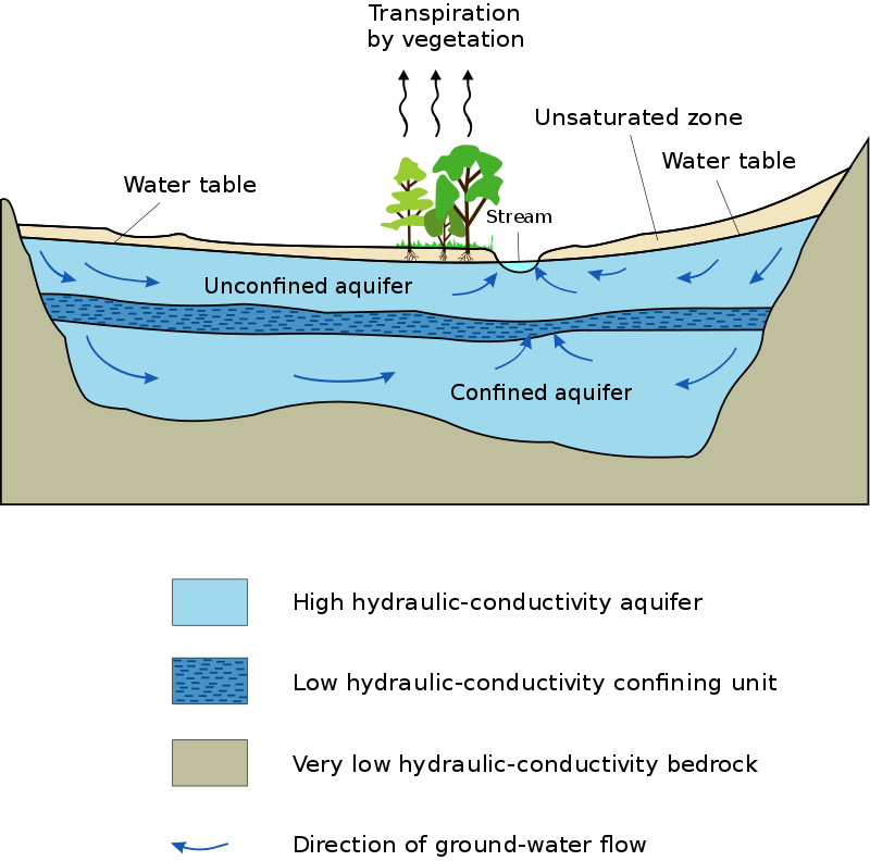
About Aquifers
Aquifers are underground reservoirs of water stored in permeable rock bordered by bedrock with very low conductivity which acts like a bowl containing the water in the aquifer. Typically an aquifer consists of pockets of water—which is not always freshwater by the way—separated by nonporous layers of rock called aquitards. A good way to understand this is by picturing the layers of a cake where the cake sections are porous and allow water to flow into the gaps, with layers of frosting (the aquitards) in between that separate different levels of porous rock and water.
If the aquitard is dense enough to completely restrict the hydraulic conductivity (which is defined as the ease with which the water can flow within the structures), then it creates two separate sections: the unconfined aquifer at the top near the water table, and a confined aquifer beneath the aquitard.
Groundwater in Guanajuato
UNSUSTAINABLE USE OF GROUNDWATER AROUND THE WORLD:
Due to the fact that groundwater is the preferred source for agriculture, industry, and rural/domestic use, then naturally it has led to unsustainable use of this natural resource. Whenever any renewable resource is used beyond what can be replenished, this is referred to as overexploitation, which means that more water is removed from the aquifer than is replenished every year.
Regulations to Protect Groundwater Levels
Regulations in most countries have been put in place restricting the use of groundwater. Many of these regulations are in the form of drilling bans, electricity pricing, rights-systems regulatory control setting assigned volumes, and drilling company regulations.
Though regulations have been put in place around the world in order to protect groundwater levels, they have been largely ineffectual in preventing unsustainable use. Nearly all countries with intensive use of groundwater continue to have unrestricted use of aquifers—which has led to many dire socioenvironmental impacts around the world.
Without regulations, groundwater user has no contrary incentives in the form of subsidies or penalties for using water irresponsibly, and thus most users continue to use water unsustainably. Water regulations attempt to regulate individual groundwater users in hopes of creating a stable ecosystem where all users can benefit.
GROUNDWATER IN GUANAJUATO, MEXICO:
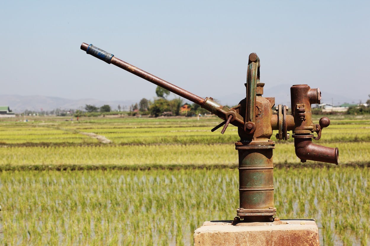
Groundwater is vastly important in Guanajuato where it supplies 99% of the urban water supply. 84% of this groundwater goes toward irrigation of 260,000 hectares for agricultural use. This means that groundwater supplies 3,900 million cubic meters of water each year, and each year only 2,800 million cubic meters are renewed. This continued practice of unsustainable use lowers the levels of Guanajuato’s aquifers roughly 2 – 3 meters per year. When wells dry up, they must be dug deeper—past the next aquitard—furthering the risk of contamination; and in the north and center of the state, large pockets of fluoride and arsenic have created a public threat to the health of the population.
Since the 1950s, state regulations have attempted to curb the unsustainable use of groundwater in Guanajuato. In 1992, a noteworthy initiative throughout all of Mexico implemented a permit system with the chance for groundwater rights transmissions. In addition, they also tried to manage groundwater levels through energy pricing.
In 1990, the state government of Guanajuato formed Aquifer Management Councils, which then became the leading example for the rest of Mexico. In addition, programs subsidized the modernization of irrigation systems in hopes of reducing agriculture’s overuse of groundwater.
Conflicting Legal Precedent for Groundwater Use
Article 27 of the Mexican Constitution states that “land and water property belong to the nation”. This article is based on a 1910 Water Law precedent that affirms that water is public property for communal use.
In 1945, an amendment to Paragraph 5 of Article 27 states that groundwater is national property:
Groundwater may be freely brought to the surface throughout artificial works and appropriated by the owner of the land, but, when it is in the public interest or if it affects the supply of other users, the Federal Government may regulate its extraction and utilization, and even establish prohibited areas, in accordance with strictures applied to other waters of national property.
Nonetheless, if we are to go by legal precedent alone, the private owner also has rights to the water. In 1884, the civil code establishes the landowner’s right to prospect and use water on their own land. The Law of Water of National Property of 1929 and 1934 also reaffirm the landowners' rights to use groundwater as they see fit.
Mostly, through the Federal Water Law of 1972, the government reserves the right to issue groundwater permits, to establish regulations for groundwater use, and to prohibit sinking new wells without the consent of the National Water Authority in certain areas. Nevertheless, as you may have assumed, these laws have been largely ineffectual.
The ineffectuality of Groundwater Regulations in Guanajuato
The simple truth is that though the legal statutes are firmly in place, the reality is that their enforcement in the field is poorly executed with administrative and legal inconsistencies. It has not curbed the uncontrolled sinking of new wells and their uncontrolled extraction in Guanajuato and throughout Mexico.
However, the National Water Authority does seem to have managed some form of control and efficacy in regulating water use. They do seem to manage to somewhat rein in the water use in the industrial sector—and, to a lesser degree, the domestic water sector. Unfortunately, the agricultural sector seems to find some way to escape real restrictions.
Groundwater in San Miguel de Allende
Groundwater Quality in San Miguel de Allende:
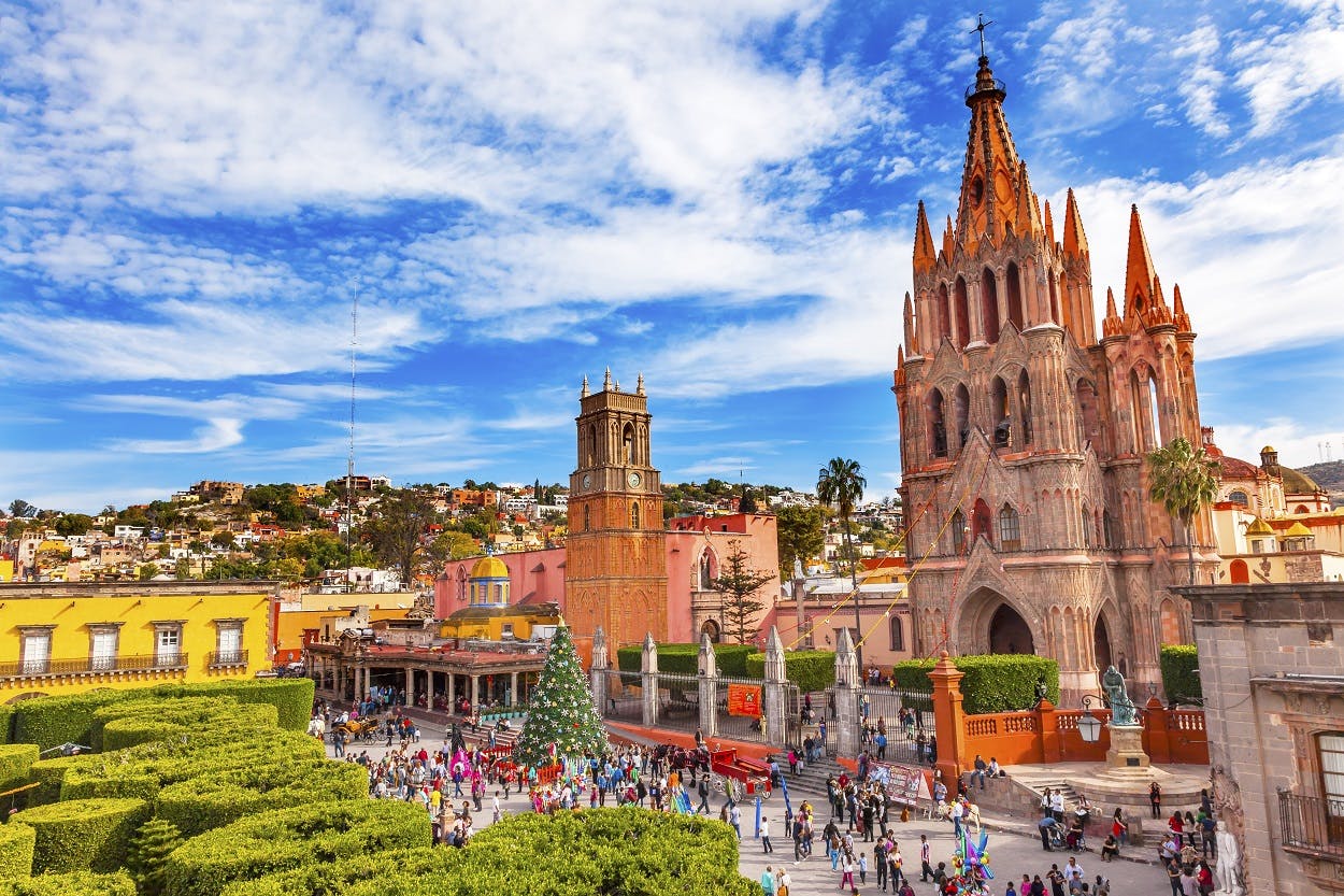
Situated in the Central Mexican Altiplano highlands of Guanajuato—over a mile in elevation—lies one of Mexico’s most important tourist and expatriate destinations: the town of San Miguel de Allende. For this reason, its economic importance has allowed a blind eye to be turned toward the deterioration in quality and the unsustainable use of groundwater in the municipality.
The municipality of San Miguel de Allende—like much of the rest of the state of Guanajuato—relies heavily on groundwater, and as we have learned in previous sections, this groundwater is an overexploited resource. This overexploitation is largely due to irrigation.
Thus, a study to evaluate the chemical byproduct levels that result from both natural and human processes in the aquifers surrounding the town of San Miguel de Allende has been commissioned.
Notes About the Natural Features of the San Miguel de Allende Municipality
In the 6,840 square-kilometer hydrological basin known as Independence Basin, the San Miguel de Allende region is a semi-arid, intermountain sedimentary basin of about 1,295 square-kilometers. This is mainly a rural area that depends heavily on agriculture.
Annually, the mean temperature is 17°C (63° Fahrenheit) because this semi-arid region has a rainy season from May – October and a dry season from November – April. The highest point of elevation in the basin is 2,600m above sea level, and the lowest point of elevation is 1,900m above sea level.
The region selected to focus the study of the water quality in San Miguel de Allende is a plains area surrounded by La Joya and Palo Huérfano Volcanoes to the southeast and south, the Sierra de Cuarzos to the northeast, the Laguna Seca to the north, and the Sierra de Guanajuato to the west.
The region selected for the study represents a major recharge area for the entire Independence Basin. In the last 30 years, a major water table drop has occurred. 83% of the water extracted has gone to irrigate broccoli, beans, chili, and corn. So much so that the groundwater table reaches 140 meters (450 feet) in the Western section of the study region.
The deepest section of the regional aquifer is located in the study region, which extends to a maximum depth of over 600m. Covering this section is a series of fractured geological formations with a maximum thickness of 400m that consist of:
- Acid ignimbrites
- andesitic lavas
- Andesitic-dacitic spills
- Lahar and breccia deposits
- Tuff deposits
- Sandstones
- Conglomerates
- Granular material
- Fluvial and alluvial sediments
– Groundwater Study in the San Miguel de Allende Municipality –
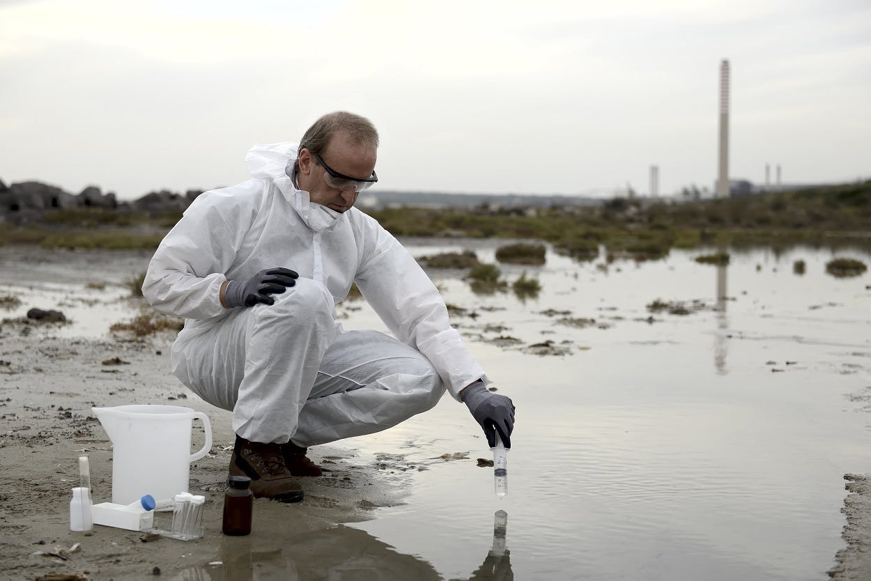
In the San Miguel de Allende municipality, 41 different production wells were sampled according to their coliform bacteria and hydrochemistry. After the physiochemical parameters were field-determined, then the cation and anion samples were then filtered (0.45mm) and stored with tri-distillate water in brand new, pre-rinsed HDPE bottles that were kept at a constant temperature of 4°C. (Also, the cation samples were acidified to a pH<2 using ultrapure nitric acid).
The Instituto Nacional de Investigaciones Forestales Agricolas y Pecuarias (INIFAP) conducted the research in Celaya, Mexico. They used the following methods to detect the following substances:
- Turbimetric Method for sulfate
- Selective Ion Electrode Method and Ion Chromatography for fluorine
- Inductive-Coupled Plasma Optical Emission Spectrometry for cations
- Argentometric Titration Method for chloride
- Counting of Incubated Membrane Filter for fecal coliform bacteria
Findings of Groundwater Study in the San Miguel de Allende Municipality
The salinity of the groundwater in the municipality of the San Miguel de Allende area is fairly low, with less than 624mg per liter of total dissolved solids. The pH is neutral registering between 6.2 and 8.3 (7 being the border between acid and alkaline).
Due to thermal conditions near the wells that were tested, the average temperature varies between 19°C and 39°C. The type of groundwater is known as calcium to sodium bicarbonate. Also, the southern area of the tested region has a local dominance of magnesium.
Using PHREEQC (a computer program that performs many different calculations of aqueous geochemistry), the results indicate that the chemical processes can be characterized by four major qualities:
- Irrigational and Natural induced evapotranspiration
- Dissolution of calcium, sodium, and potassium silicates
- Interaction of deeper thermal water with silicates
- Carbonate dissolution
Fluorine
Fluorine concentration was incredibly high in 16% of the wells examined—4 times the concentration that is admissible in Mexico (MAC) for drinking water. The fluorine concentration was 5.9mg per liter to be precise. The specific distribution of high levels of fluorine was found in the vicinity of Allende Dam.
*One thing is certain. Human causes for the fluorine have been excluded because of the characteristics of the area—the water table configuration as well as the rural nature of the area surrounding Allende Dam. In addition, dissolved fluorine is associated with chlorine, sodium, and water temperature—quite similar conditions to the aquifers near Allende Dam—leading to the conclusion that the occurrence of the fluorine is geological.
Arsenic
In 15% of the groundwater samples, the groundwater is higher in arsenic than the guidelines by the World Health Organization. The rest of the samples contained 16μg (micrograms, equal to one millionth of a gram) per liter, which is well below the MAC of 30μg per liter. It is likely that the high levels of arsenic in 15% of the samples result from the aquifer groundwater mixing with regional groundwater that has a deep circulation while forming Magnesium oxyhydroxide.
Lead
In addition, lead also appears in high concentrations in 8% of the sampled water—exceeding the MAC levels of 10μg per liter. Two major hypotheses seem to explain the phenomenon pretty well:
- The groundwater has come in contact with older well tubing made of lead
- The groundwater has come in contact with hydrothermal water containing sulfide minerals where lead is dissolving.
If given the choice, the former is more likely, because it would perfectly corroborate the rusted pumping well materials that were found in the field survey of the sampled wells where lead concentration was considered a problem.
Nitrates
In only one sample out of the 41 samples did nitrates exceed the MAC limits. For the most part, nitrates were not an issue. The concentration ranged between 0.01 and 11.5mg per liter.
Bacteria
Microorganism contamination of groundwater in Guanajuato is of increasing concern. In 85% of samples of groundwater in Guanajuato, coliform bacteria was found at alarming levels. Clearly, water disinfection treatments have been either negligent or completely absent. In many of the sampled wells, the levels of coliform bacteria are off the charts, reaching levels otherwise “uncountable”. The highest concentrations are found in the region of the town of San Miguel de Allende in the western part of the sample region, and in Corral de Piedra de Arriba in the northern section of the sample region.
Conclusion of the Water Study in San Miguel de Allende
The microorganisms in the groundwater in the San Miguel de Allende municipality are of concern because they could affect the health of those who drink it—including some fairly serious stomach and digestive ailments. It is recommended that all water be thoroughly sanitized before ingesting it.
In addition, the arsenic, fluorine, and other metals present will not present a human adult any lasting issues in the short term. However, over long periods of time, these contaminants could have disastrous effects on the health of those who ingest this groundwater—including cancer and other degenerative conditions.
Perhaps most dire are the dangers that these contaminants present to children. Nearly all of these heavy metals constitute a clear and present danger to those children whose brains are still forming. These contaminants could lead to lasting health conditions, degenerative conditions, and other neurological ailments. It is highly recommended that children avoid drinking groundwater in the San Miguel de Allende municipality at all costs.
RADIATION FOUND IN AQUIFERS IN GUANAJUATO:
*The following data is based on these articles by El Universal, as well as this article by Mexico News Daily. (Their data is currently in question and Expat Insurance encourages you to investigate the sources cited in these articles for their validity):
In the Guanajuato region of San Jose Iturbide, high levels of radioactivity were found by the Universidad Autónoma de México, or UNAM in October of 2016, prompting officials to release a warning. At least 2,500 wells were shown to have radiation contamination. Radiation is 300% above the tolerable levels for human consumption. 46 wells were identified in critical condition: 31 of them with fluoride limits that exceed MAC, and 14 of them with arsenic limits that exceed MAC.
Over half of the contaminated wells provided water for farming, and at least 5 people died from health-related complications from the radiation. In addition, dozens of stomach cancer cases are possibly connected, and the research continues at the UNAM campus in Santiago de Queretaro.
Girls under 12 years of age have contracted fatal cases of lymphoblastic leukemia, and these cases have been directly linked to a well contaminated with elevated levels of alpha radiation that supplies water to three communities in San Jose Iturbide.
At least 45 deaths have been linked to the radioactive contamination, including 14 deaths by very rare forms of cancer, which only corroborates the theory that they are caused by groundwater in Guanajuato.
The contamination could possibly be a result of arsenic and fluoride contaminants whose levels have doubled in the last 14 years. Arsenic is a known carcinogen. These could likely be a result of overexploitation because the contaminants seem to be in deeper groundwater aquifers that do not circulate well, and the shallower aquifers have all but dried up.
In addition, fluoride affects bone development and the skeletal structure itself; between 8,000 and 11,000 cases of dental or skeletal fluorosis have been registered in Independence Basin in the last 15 years. Guanajuato also ranks 5th highest in Mexico for kidney disease—which could also be a sign of fluoride contamination.
The UNAM's Center of Geosciences (or CGEO) has identified high levels of fluoride, arsenic, and other heavy metals in 10 municipalities in Guanajuato:
- San Miguel de Allende
- Tierra Blanca
- Celaya
- Irapuato
- San Luis de la Paz
- Doctor Mora
- Leon
- San Jose Iturbide
- San Diego Union
- Dolores Hidalgo
*For more information on radiation in Guanajuato, click here.
*In San Miguel de Allende, communities have begun to organize and act. To learn more, click here.
A NOTE ON THE DIFFERENCES OF WATER TERMS AND THEIR RELATION TO THE EFFICACY OF WATER POLICY:
The non-uniform nature of definitions of crucial terms such as “scarcity” and “water crisis” add to problems in policy implementation. They can be definitions based on water in an aggregated area or in per capita terms. These definitions are often borrowed from industrialized fields like hydraulic engineering, hydrology, applied water management. . . etc.
These definitions for crucial terms are then reflected in the making and implementation of policy—as well as how governments, NGOs, and private water service providers finance and subsidize water programs aimed at alleviating what their definitions of “scarcity” or “water crisis” entail. (The issue is that these approaches can be effective in alleviating their definition of “water scarcity”—for example—without improving the lives of those whose water security necessitated the policy in the first place!)
Some initiatives could work better to alleviate crises in industrialized middle-class areas by managing the sustainability of adaptation of water supplies. However, attempting to make policy by those same definitions in rural areas often fall far short of the mark.
Instead, initiatives by individuals and the private sector tend to operate better with ad hoc systems that are better equipped in their flexibility to tackle the vicissitudes of water management in rural areas—and those of limited means living on the outskirts of urban centers who also lack water security.
Unfortunately, standardized approaches based on term definitions that apply to fields that are not directly concerned with water conservation and availability (but are instead concerned with water engineering and are loosely related to water infrastructure) often create more problems for those in the rural communities whose water insecurity spurred the initiatives.
Therefore, a shift in paradigm must be placed from a model centered around the resource to a model that allows for flexible and adaptable approaches. No longer are water conservationists looking for a one-size-fits-all solution, but instead are looking to alleviate the water scarcity issues in a given location through trial, experience, and experimentation. Individual models must be drafted to take into account the household usage patterns and water supply chains of a given area.
This means that the bottom line of any initiative should no longer be one of water outputs, but instead, a final goal centered around the alleviation of the individual human suffering of those involved in water scarcity crises.
Get An Insurance Quote
Are you an expat living abroad? Compare insurance prices instantly now.
Fill in your email to get quotes for:
Health
Travel
Life
Home
Boat
Auto
